
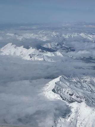
February 1st Water Supply Outlook Report for Utah
Utah got a nice boost to its snowpack in January! The statewide snow water equivalent (SWE) percent of normal increased from 69% at the beginning of the month to 95% by month’s end. Not bad! Similarly, on January 1st all of Utah’s major basins were below 80% of normal SWE, but as of February 1st the opposite is true; all of our major basins are now above 80%. The individual SNOTEL site with the highest SWE total as of February 1st is the Ben Lomond Peak site at 25.3” SWE, with the Atwater and Tony Grove Lake SNOTELs close behind. Utah’s snowpack conditions have continued to improve since February 1st, but this report is based on conditions as of the first of the month.
Every major watershed in Utah received above normal precipitation for the month of January, with >150% of normal monthly totals for the Duchesne, San Pitch, Price-San Rafael, Upper Sevier, Dirty Devil, and Raft watersheds. As of February 1st, the water-year-to-date precipitation value for Utah was 93% of normal, up 15% from the previous month.
Statewide soil moisture is at 52% of saturation, which is very close to last year’s value and is 105% of normal. Generally-speaking, soil moisture conditions are typical (or better) for this time of year for all of Utah’s major basins except for Southeastern Utah. As noted in previous reports, where present the relatively moist mountain soils will help promote runoff efficiency in the spring.
Utah’s streamflow forecasts for April to July snowmelt runoff volume are very similar to those produced by the Colorado Basin River Forecast Center and are more optimistic than last month due to the improved conditions in our mountains. Forecasted flow ranges from 72% to 170% of median (20% to 110% of average). As noted in last month’s report, water users should beware of misplaced optimism while assessing forecasts based on percent of median for most areas of the state. We recommend focusing on the forecast value itself or the percent of average when assessing these streamflow predictions. Forecasted streamflow is most optimistic for the Wasatch Front, Weber-Ogden, Bear, and Strawberry watersheds. However, conditions need to substantially improve in southern Utah to result in better runoff predictions for this summer. As of this writing, February is off to a promising start!
Utah’s reservoir storage continues to reflect the benefit of last winter’s outstanding snowpack and the conservation measures promoted across the state. Our current statewide reservoir storage is at 80% of capacity, compared with 49% last year at this time. Surface Water Supply Indices (SWSI) for Utah basins combine our current reservoir levels with the additional volume of water anticipated for each watershed based on these February 1 streamflow forecasts. While some areas of the state with significant ground to make up (due to large amounts of depleted reservoir storage) have low SWSI values, such as the Lower Sevier basin, SWSI values for most of the state are close to average (50th percentile), suggesting that water supply conditions will be close to normal for those areas. A few basins are expected to have well above-normal water supply conditions, such as the Provo and Price watersheds.
As introduced last month, we are now able to include basin-level conditions and inflow forecasts for the Great Salt Lake (GSL) in our monthly Water Supply Outlook Reports. This new section of our report includes updated GSL basin-wide conditions (SWE, precipitation, soil moisture, and reservoir) as well as forecast details (predicted April through July inflow volume as well as modeled lake level rise from February to this year’s peak water elevation). Currently, SWE in the GSL basin is 102% of normal, with 101% of normal water year to date precipitation. Soil moisture is well above normal at 64% of saturation, and the basin’s reservoir storage is at 82% of capacity, up 32% from last year at this time. The 50% exceedance forecast for April through July inflow into the GSL is 645 thousand acre-feet (143% of median, 90% of average) which would result in a lake level rise of roughly 1.2 feet predicted from the beginning of February until the lake reaches its peak water elevation for this year. Please contact us with any questions related to these data and bear in mind that inflow forecasts for the GSL include substantial uncertainty.