
March 1st Water Supply Outlook Report for Utah
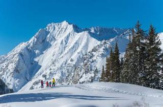
February was a great month for Utah’s snowpack! We received 157% of our typical amount of snow water equivalent (SWE) for the month, and our statewide SWE percent of normal ended the month at 117%. That is 48% higher than at the beginning of the calendar year! Utah’s statewide SWE has now exceeded our typical annual peak, meaning that even if we don’t receive any more snow this winter, we are still guaranteed an above normal snowpack season. With the historic 2023 winter barely in our rearview mirror, it’s outstanding to see this winter come through with above normal conditions. Better yet, all of Utah’s major basins now have above normal snowpack except for the Beaver (which is close), so the benefits of another good snowpack season are likely to be felt statewide. That said, northern Utah has done particularly well thus far this winter season.
Utah received 180% of normal precipitation for the month of February! It was an outstanding month. In fact, the monthly total precipitation broke records at 6 of Utah’s SNOTEL sites (Mining Fork, Louis Meadow, Cascade Mountain, Lakefork Basin, and Kings Cabin in northern Utah, and Clayton Springs in southern Utah) and were second highest at an additional 12 sites. As of March 1st, the water-year-to-date precipitation value for Utah was 111% of normal, up 18% from the previous month. As for January, every major watershed in Utah received above normal precipitation during February, with >200% of normal monthly totals for the Raft, Duchesne, and Escalante-Paria watersheds. Wow!
Statewide soil moisture is at 56% of saturation, which is 108% of normal. As noted last month, soil moisture conditions are generally close to normal for this time of year for most of Utah’s major basins except for the Price-San Rafael, San Pitch, and Southeastern Utah areas which have abnormally dry soils.
Utah’s streamflow forecasts for April to July snowmelt runoff volume range from 83% to 223% of median (42% to 154% of average). Note that we recommend focusing on the forecast value itself or the percent of average when assessing these streamflow predictions (see discussion on pages 2-3 here). Forecasts are generally for above normal flows in northern Utah—particularly the Bear, Weber, and Provo-Jordan basins—close to normal flows in central Utah, and below normal flows in southern Utah—particularly for the Sevier, Beaver, and Southwestern Utah areas. Specific details are listed in each basin’s section of this Water Supply Outlook Report.
Utah’s current statewide reservoir storage is at 82% of capacity, which is 31% higher than last year. Surface Water Supply Indices (SWSI) for Utah basins combine our current reservoir levels with the additional volume of water anticipated for each watershed based on these March 1 streamflow forecasts. The SWSI for the Lower Sevier basin is concerning as it is below the 20th percentile. Everywhere else in the state is predicted to have close to normal surface water availability this summer (close to 50th percentile), with a few areas (Provo, Weber, and Price drainages in particular) predicted to have a well above normal water supply. These optimistic SWSI values reflect the impressive carryover storage in Utah’s reservoirs as well as the improving snowpack conditions and resulting runoff forecasts.
For the first time, this year we are able to include basin-level conditions and inflow forecasts for the Great Salt Lake (GSL) in our monthly Water Supply Outlook Reports. This new section of our report includes updated GSL basin-wide conditions (SWE, precipitation, soil moisture, and reservoir) as well as forecast details (predicted April through July inflow volume as well as modeled lake level rise from March to this year’s peak water elevation). Currently, SWE in the GSL basin is 123% of normal. February precipitation in the GSL basin was 183% of normal, bringing the water year to date precipitation value to 118% of normal. Soil moisture is well above normal at 67% of saturation, and the basin’s reservoir storage is at 84% of capacity. With only 16% of available capacity remaining to fill in GSL basin reservoirs, it is likely that a large amount of additional water will be available to flow into the Great Salt Lake itself once all that snow melts. The 50% exceedance forecast for April through July inflow into the GSL is 870 thousand acre-feet (122% of average, 193% of median) which may result in a lake level rise of roughly 1.2 feet predicted from the beginning of March until the lake reaches its peak water elevation of around 4195 ft for this year.
This lake level rise prediction uses two methodologies: first, we modeled the probabilistic range for the lake’s rise from the historical relationship with current snowpack and precipitation conditions in the GSL basin (essentially the same process as we use for our other forecast points). This approach determines which upstream SNOTEL sites typically have the strongest statistical relationship with lake level rise, found from the range of previous observations. The same suite of upstream points is then used to predict this year’s forthcoming rise based on current conditions. Second, we added the 50th percentile inflow forecast volume of 870 thousand acre-feet (which combines the expected flows into the GSL from the Bear, Weber, and Jordan Rivers) to the current volume of the lake to determine this year’s peak elevation from the stage to volume relationship for the lake.
However, please bear in mind that both our inflow forecast and predicted lake level rise for the GSL include substantial uncertainty, including (1) unlike other forecast points in Utah, predicted flows into the GSL do not account for management actions upstream, such as withdrawals for diversions or storage in reservoirs. (2) Similarly, this year’s forecasts are blind to the small remaining reservoir capacity in the GSL basin and the (high) potential for substantial excess water to make it to the lake after upstream reservoirs are filled. (3) The first approach above does not (yet) consider changes in storage for Willard Bay (these will be included in next year’s runoff forecast). (4) The second approach used above does not consider complications in the lake’s stage to volume relationship due to the existence (and recent changes in the condition) of the berm separating its south and north arms. (5) The second approach above also does not explicitly include losses of water in the lake due to evaporation nor additions due to direct precipitation onto the lake itself. Finally (6), the second method above only considers the 50th percentile exceedance forecast and ignores the wide range of forecasted probabilistic inflow volumes. That’s a lot of caveats! Our inclusion of this inflow forecast and predicted lake level rise is meant to provide very rough guidance for Utah’s water managers in light of the high level of interest in the lake’s condition and numerous actions to restore lake levels. Please contact us with any questions related to these data or methodologies.